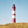
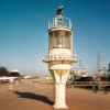
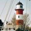
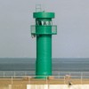
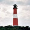
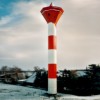
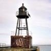
Amrum / Rear light Amrum harbour
54° 37.9' N
08° 21.3' E
Germany(North Sea)
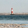
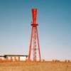
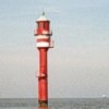
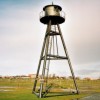
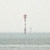
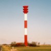
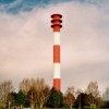
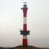
Arngast
53° 28.9' N
08° 10.9' E
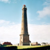
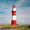
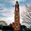
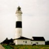
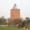
Borkum - big lighthouse
53° 35.0' N
06° 40.0' E
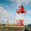
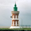
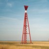
Borkum - cross light "Düne"
53° 34.5' N
06° 40.0' O
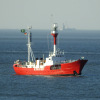
Borkum - lightship Borkumriff
53° 33.6' N
06° 45.0' E
Borkum - little lighthouse
53° 34.6' N
06° 39.9' E
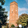
Borkum - old lighthouse
53° 35.3' N
06° 40.4' E
Bremerhaven Kaiserschleuse
53° 33.2' N
08° 33.6' E
Bremerhaven lightship Fehmarnbelt - lantern
53° 32.5' N
08° 34.4' E
Bremerhaven pier light Geestemündung north
53° 32.2' N
08° 34.5' E
Bremerhaven pier light Geestemündung south
53° 32.1' N
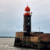
Bremerhaven rear light
53° 32.8' N
08° 34.2' E
Bremerhaven rear light Fischereihafen
53° 31.3' N
08° 35.1' E
Bremerhaven front light Fischereihafen / Geestemündung
53° 31.9' N
Bremerhaven rear light Geestemündung
53° 32.0' N
08° 34.8' E
Bremerhaven front light
53° 32.7' N
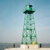
Brinkamahof
53° 31.0' N
08° 34.6' E
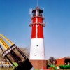
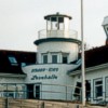
Büsum lighthouse
54° 07.7' N
08° 51.6' E
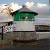
Büsum old pier light
54° 07.6' N
Büsum port light
54° 07.2' N
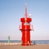
Büsum starboard light
08° 51.7' E
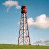
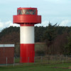
Campen
53° 24.4' N
07° 01.0' E
Cuxhaven-Duhnen
53° 52.9' N
08° 37.5' E
Dagebüll
54° 43.6' N
08° 41.7' E
Eckwarden leading lights
08° 14.0' E
Emden
53° 20.1' N
07° 10.6' E
Fischerbalje
06° 43.0' E
Hofe leading lights
53° 37.6' N
08° 29.2' E
Hörnum (Sylt)
54° 45.3' N
08° 17.5' E
Imsum cross light
53° 35.8' N
08° 31.1' E
Imsum leading lights
08° 32.0' E
Kampen (Sylt)
54° 56.8' N
08° 20.5' E
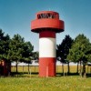
Knock
53° 20.4' N
07° 01.5' E
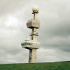
List East (Sylt)
55° 03.0' N
08° 26.7' E
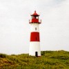
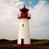
List West (Sylt)
55° 03.2' N
08° 24.2' E
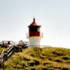
Nebel (Amrum)
54° 38.8' N
08° 21.7' E
Neuwerk
53° 54.9' N
08° 29.7' E
Nieblum (Föhr)
54° 41.1' N
08° 29.1' E
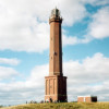
Norddorf (Amrum)
54° 40.3' N
08° 19.0' E
Norderney
53° 42.6' N
07° 13.8' E
Nordmarsch (Hallig Langeneß)
54° 37.6' N
08° 31.8' E
Oland
54° 40.5' N
08° 41.3' E
Olhörn (Föhr)
54° 40.8' N
08° 34.0' E
Pellworm former front range
54° 29.3' N
08° 39.1' E
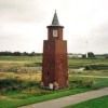
Pellworm
54° 29.8' N
08° 40.0' E
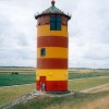
Pilsum
53° 30.4' N
07° 03.1' E
Rotes Kliff (Sylt)
54° 57.7' N
Sandstedt old front range
53° 32.4' N
Sandstedt old rear range
53° 22.0' N
08° 30.8' E
Sandstedt rear light
53° 21.9' N
Sandstedt front light
53° 21.7' N
08° 30.7' E
St. Peter (Böhl)
54° 17.3' N
08° 39.2' E
Schillig leading lights
53° 42.0' N
08° 01.7' E
Solthörn leading lights
53° 38.6' N
08° 26.9' E
Tossens leading lights
53° 32.8 N
08° 14.3' E
Voslapp rear light
53° 34.9' N
08° 07.8' E
Voslapp front light
53° 37.2' N
08° 06.8' E
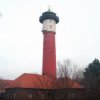
Wangerooge - new lighthouse
53° 47.4' N
07° 51.4' E
Wangerooge - old lighthouse
53° 47.3' N
07° 53.9' E
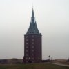
Wangerooge - West tower
53° 47.1' N
07° 51.3' E
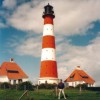
Westerheversand
54° 22.5' N
08° 38.5' E
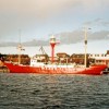
Wilhelmshaven lightship Weser
53° 30.6' N
08° 08.3' E
Wilhelmshaven marine pier
53° 32.3' N
08° 10.2' E
Wittdün (Amrum)
54° 37.5' N
08° 23.5' E
Wriakhörn (Amrum)
08° 21.2' E
Wybelsum
53° 20.2' N
07° 06.6' E
top of page
home